A few years ago, I created a New Map for London. Since then, I’ve been meaning to update this for a while, but life got in the way. Although I’m usually terrible with New Year’s resolutions, I said one this year will be to finally update and publish. Fortunately, here we are, 15th February 2026 and I’ve finally done it.
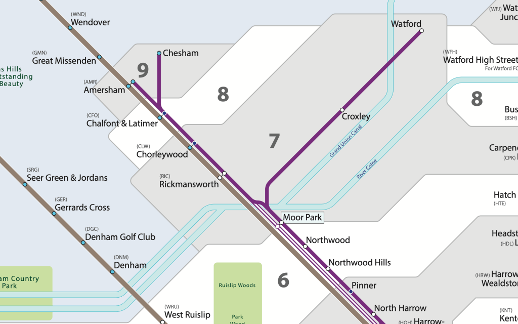
Since the last full update, I’ve made little changes which I think add up to a lot, with the aim of it looking more polished, softer and clear – no more sharp edges for zones; a lighter colour for stations in two zones; fully encasing lines with a white/light grey, amongst other little tweaks.
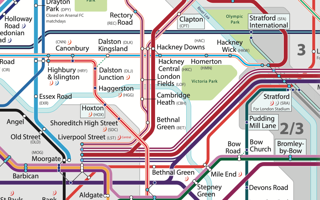
I’ve also updated the routes for 2026. The routes of London Overground are now identified; this something I considered doing before, using the official railway line names (these haven’t officially changed), but decided against it as they’re not used in public facing wayfinding . But the Mildmay Line will always be the North London Line to me! And who can forget the GOBLIN?.
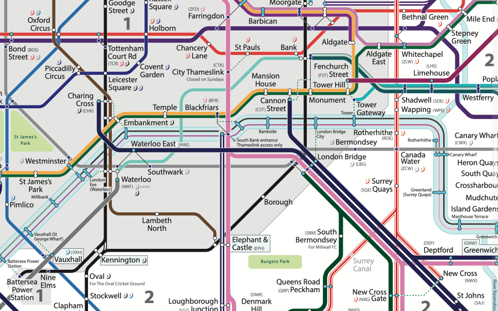
River Bus (Uber Boat) services have had a reorganisation since 2023, something I didn’t realise until now, so I have updated accordingly. The colours used are essentially the ones used on the Uber Boat map as well as the likes of Google Maps and the TfL Service Updates, but for some reason, the TfL River Map continues to use the old colours.
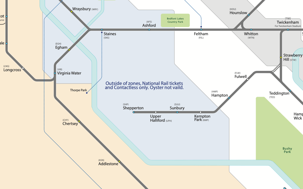
As contactless has expanded, I’ve changed the also updated this (and lightened the blue), however, I don’t plan to expand this map to cover the entire contactless area as it expands; this is a map more for London and the immediate surrounding area, and not all the way to Shoeburyness, of course!
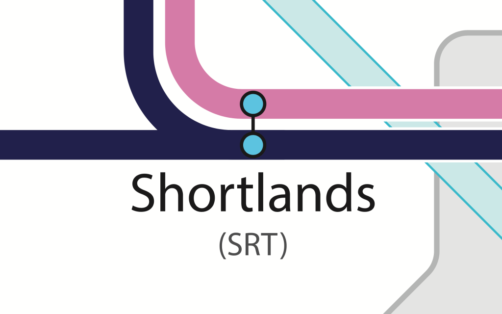
I’ve also updated stations which have had Step Free Access added, like Shortlands above. I hope I haven’t missed any – please do let us know if I have, or if I’ve got any wrong. As a reminder, I’ve essentially used the TfL standards for designating step free access, so if a station only has step free access to say 1 of 2 platforms this isn’t classed as a step free station. For more info, constantly updated, do have a look at the National Rail website’s station information or TfL.
Finally, I had a version I made a while ago with Superloop (the new Express Bus Network) orbital routes added on. I thought this was useful particularly for orbital travel in Outer London, and accessing places not served directly by rail transport, such as Shirley, Thamesmead and Yeading. I’m very jealous of Île-de-France’s expansion of orbital travel with the Grand Paris Express project building several orbital Metro Lines, as well as their Orbital Tram expansion. However, I’ve decided not to have this for this update. Ultimately, as the Superloop network continues to expand, the more difficult it becomes to map, thus cluttered and clarity starts to become compromised, I may revisit this in the future, possibly doing it differently, possibly with just a symbols for stations where you can alight.
So, here it is, the 2026 version of Rail & River services within the London Metropolitan Area.
Best, Mappingford